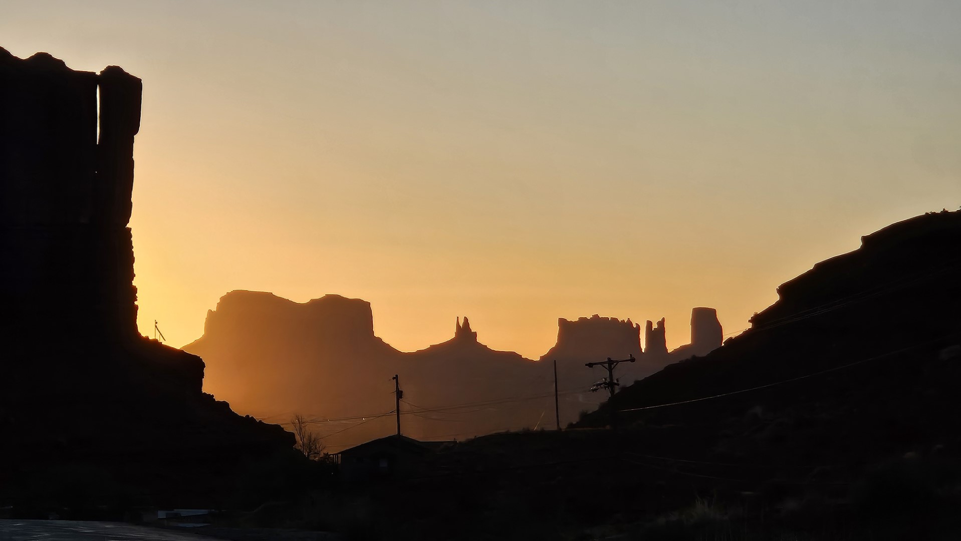
Today was dedicated to seeing the monuments in Monument Valley and other spectacular scenery around our campsite.

We started by going to the nearby Monument Valley Navajo Tribal Park where we drove Polo around the scenic drive and took lots of pictures.


Then we went back to Khan for lunch and Scott’s nap.
Then back on the road. 1st stop was the famous road scene in Forest Gump where he ends his long running period. Due to the crowds on the road we used Polo to drive a bit off of route 163 to take pictures.


We then passed through Mexican Hat and found a side road that, according to a handmade sign, went to a campground you could pay for online. When we got to the campground area, we found we could go further and we ended up driving all the way to the canyon created by the San Juan river. Very nice views that most do not see.

Next was Goosenecks State Park , for more views of the same canyon. According to the website and instructional signs, “this small park affords impressive views of one of the most striking examples of an entrenched river meander on the North American continent.” This means the river started in an environment like the Mississippi, meandering on an almost flat terrain. As the land rose the river kept cutting the same path.


Next was the Moki Dugway – an exciting steep climb up the side of a mountain with several sharp switchbacks and amazing scenery. The link has more information on its history as a mining road for Uranium deposits. A dugway is just a road dug into the side of a mountain.

After completing the Moki Dugway we drove to East Muley Point for another view of the San Juan, also described in the link. We found someone camping in a trailer near the edge of the cliff.
Then we reversed down the dugway and drove the entire length of the Valley of the Gods road. This was fitting for off-roading capabilities of Polo, and had many different monuments though Scott, at least was getting overloaded with extremely cool views. As with other parts of the National Recreation Area, there were lots of people parking their RVs and camping just off the road.


Apparently, people in or visiting Utah like to leave their mark with stickers. They show up everywhere.

As we returned to our campsite, we saw increasingly large dust clouds and experienced high winds. We were concerned that we would be unable to cook our hamburgers, but the grill only blew out once while Scott cooked them.

Long day and early meetings tomorrow. We only watched half of “Stagecoach” last night – don’t know if we will be able to stay awake tonight to watch the rest.